


Tour Grangeneuve

jwo47
User
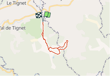

Length
5.8 km

Max alt
280 m

Uphill gradient
110 m
Km-Effort
7.3 km

Min alt
212 m

Downhill gradient
109 m
Boucle
Yes
Creation date :
2020-11-15 12:56:32.0
Updated on :
2020-11-15 14:38:49.845
1h41
Difficulty : Unknown

FREE GPS app for hiking
 SityTrail
IGN / Geographical institutes
SityTrail Plus
The world is yours!
About
Trail Walking of 5.8 km to be discovered at Provence-Alpes-Côte d'Azur, Maritime Alps, Le Tignet. This trail is proposed by jwo47.
Description
Grangeneuve
Positioning
Country:
France
Region :
Provence-Alpes-Côte d'Azur
Department/Province :
Maritime Alps
Municipality :
Le Tignet
Location:
Unknown
Start:(Dec)
Start:(UTM)
327497 ; 4833252 (32T) N.
Comments